
Residents of Guelph have been witnessing trucks similar to Google Street View vehicles driving around with large cameras on top in recent weeks. These trucks are on a mission to collect millions of laser measurements of trees lining the streets to develop a detailed three-dimensional virtual map of the city’s tree inventory. Guelph’s program manager for forestry and sustainable landscapes, Dave Beaton, highlighted that this initiative aims to enhance the city’s tree management and work towards achieving a 40% tree canopy cover by 2070.
Beaton emphasized the significance of accurate data in improving tree management practices, leading to better outcomes for the urban trees. The current tree inventory in Guelph is outdated, approximately 12 years old, and needs to be updated to reflect the changes in the tree population due to growth, removals, and new plantings.
The new system involves trucks equipped with mobile LiDAR scanners that capture detailed measurements of trees, including height, trunk diameter, canopy size, and location as they traverse through neighborhoods. Additionally, the trucks gather data on surrounding infrastructure such as signs and hydrants during the scanning process.
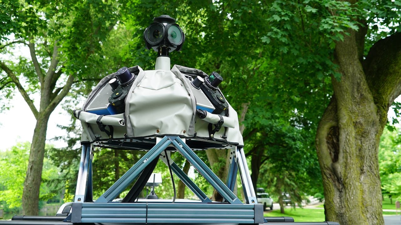
Working in partnership with Jakarto, a Quebec-based mapping company, the project aims to create a highly accurate digital twin by collecting two million measurements per second during the data collection process. This data will be crucial in identifying planting opportunities, enhancing long-term planning, and focusing on areas with lower canopy coverage.
The collected information will not only help in updating the city’s tree inventory and infrastructure map but will also assist in efficient tree planting strategies. Beaton anticipates that within two months, Guelph will have a comprehensive and updated inventory, along with a 3D virtual map of urban trees and public infrastructure, significantly expediting the process compared to traditional methods.
Expanding the Digital City Model
The digital twin created through this process serves as an engineering-grade virtual model of the city, offering a detailed replica of the urban environment. This model provides city staff with tools to measure and inspect city infrastructure remotely, streamlining asset management processes.
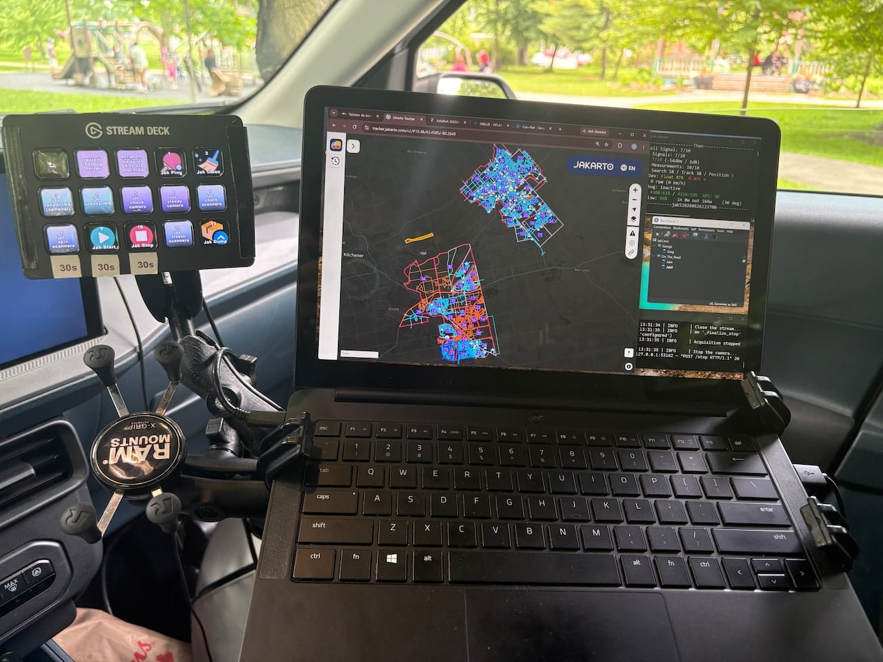
Similar technology is being implemented in Cambridge for urban planning and development decisions. By combining existing aerial 3D mapping data with new street-level scans, the city aims to enhance its virtual model, providing a more detailed perspective for planning decisions and public engagement.
The long-term goal for Guelph is to achieve 40% tree canopy cover by 2070, requiring the planting of an additional 3.6 million trees. Beaton envisions this project as a step towards making Guelph more climate-resilient, ensuring a greener and cooler urban environment for the future.
